
It’s December and it seems like winter is taking its time to fully set in. In most spots across the western US, the snowpack is below average. The season is slowly shaping up and it looks like snow is in the forecast. Take some time to do a snow dance or burn some skis for Ullr because we can all benefit from a deeper snowpack.
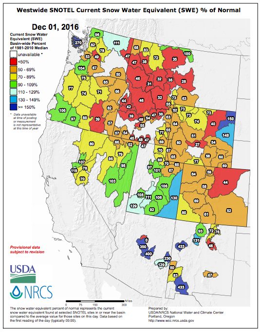
Let’s take a look at the snow data for the western US compared to normal. Below is the Westwide SNOTEL Current Snow Water Equivalent % of Normal as of December 1, 2016. You can link to the most recent data from the USDA’s Natural Resources Conservation Service here. It’s updated daily throughout the winter.
See how this month compares to past months in our past Snotel posts.
SnoTel data is one of the best ways to find out where the snowpack is deep and the coverage is above average. Are you already to plan your next skiing adventure? Enjoy the snow. Be safe out there.
#amountainjourney #eternalstoke #wheresthesnow #snotel


