
It’s December. Snow has been falling regularly in the mountains across the Northern hemisphere. Chair lifts are spinning and people are earning their turns everyday now. Winter is here.
Let’s take a look at the snow data for the western US compared to normal. Below is theWestwide SNOTEL Current Snow Water Equivalent % of Normal as of December 1, 2015. You can link to the most recent data from the USDA’s Natural Resources Conservation Service here. It’s updated regularly.
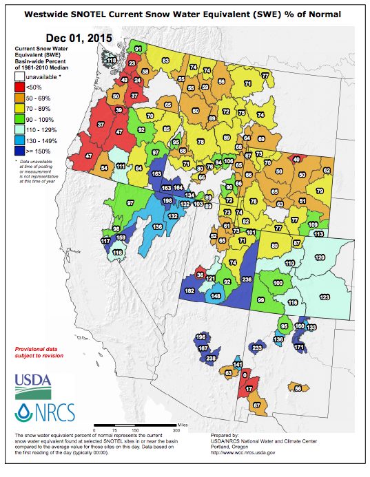
While much of the western US is still below average, CA, parts of UT, and CO are looking pretty solid right now. It’s also interesting to compare this month to past months. Find past SNOTEL data links here.
SnoTel data is one of the best ways to find out where the snowpack is deep and the coverage is above average. Get the latest SnoTel info and plan your next epic and snowy adventure. Where will you be heading?
Enjoy the winter. See you in the mountains. Be safe.


