
Climbing Beehive Peak via the Southwest Couloir
Location: Standard Route, Beehive Peak, Beehive Basin, Spanish Peaks Unit, Lee Metcalf Wilderness, Madison Range, Montana
Type: Peak
Rating: Grade II Class 2
Trailhead: Beehive Basin Trailhead – 7,900′
Distance: 8.5 miles
Time: 4 to 8 hours round trip
Beehive Peak Elevation: 10,742′ | 3274 m
Total Vertical: 3025′
Lat/Long: 45.35410°N / 111.4051°W
Maps: Lone Mountain
Find More Montana Trip Reports
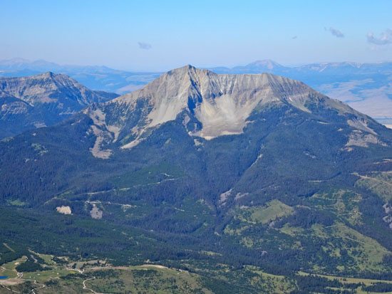
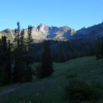
Beehive Basin is one of the most popular hikes in the world according to FoxNews.com. This prominent summit sits at 10,742′. at the head of the glacially carved Beehive Basin. It is the second highest peak (Gallatin Peak is #1) in the Spanish Peaks Unit of the Lee Metcalf Wilderness in the Madison Range near Big Sky, Montana. Officially it is unnamed on USGS Maps, but everyone knows Beehive Peak as it is a stunning summit when viewed from any direction.

Beehive Peak has numerous climbing routes that reach its exposed summit. Those routes range from 4th class scrambles to 5.11. Climbing Beehive Peak should be taken seriously at all times via all routes. This trip report is about scrambling / climbing Beehive Peak via the Southwest couloir. For you skiers out there, the southwest couloir is often called the 4th of July Couloir. I refer to this as the standard route as it is the most popular route to the summit.
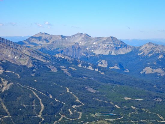
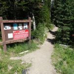
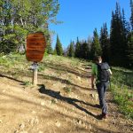
Jeremy Wood and I set off bright and early to climb Beehive Peak. We parked at 7,900′ at the ever popular Beehive Basin Trailhead. FYI – If you get here late, you’ll be searching for a parking spot. We hit the well trodden Beehive Basin Trail #40 at 7:30 AM. The trail is very straightforward and Beehive Peak can be seen in the distance for the majority of the hike in. There is one turn off that is well marked once you hit the meadows, but it would be hard to go the wrong way. See our full trip report for just hiking the Beehive Basin Trail for more information.
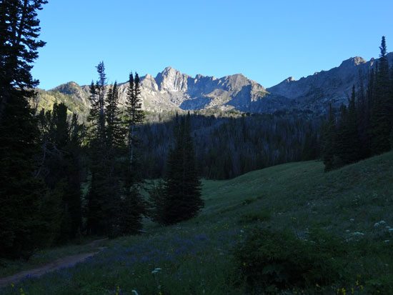
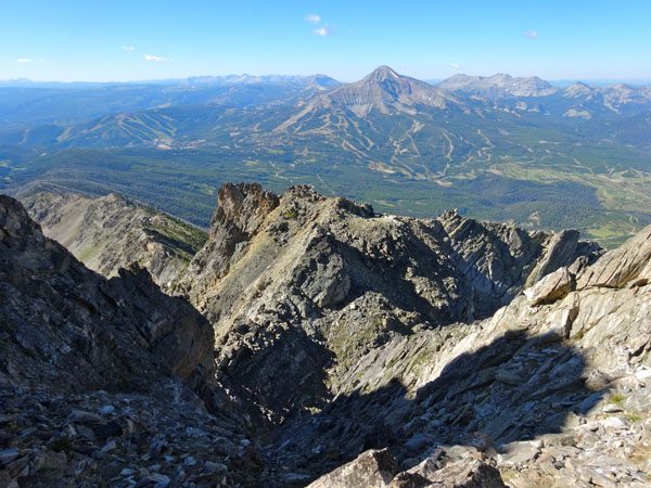
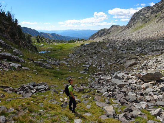
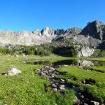
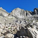
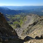
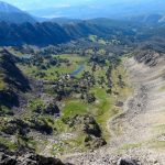
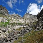
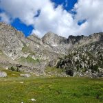
The trail soon enters the Spanish Peaks Unit of the Lee Metcalf Wilderness. After 3.3 miles and 1 hour later we reached the small lake in Beehive Basin. This is not Beehive Lake, just an unnamed mountain lake. The trail continues around the lake and up and under the towering rock formation called the Prow. The trail becomes a bit harder to follow and soon ends at a rocky outlook.
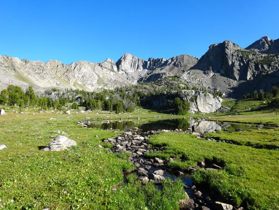
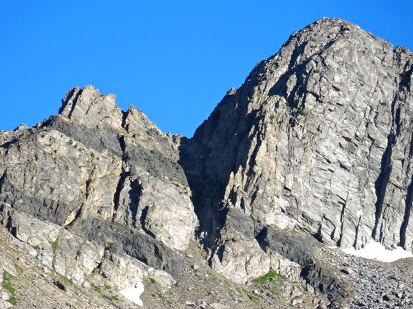
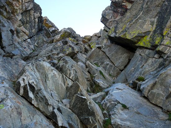
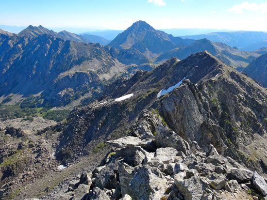
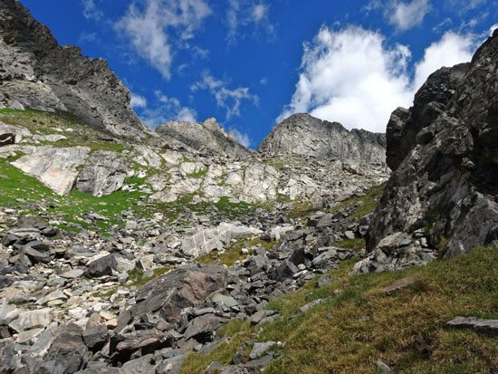
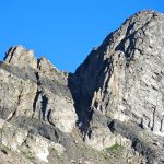
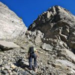
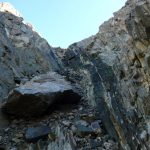
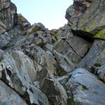
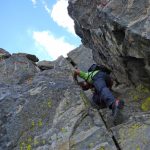
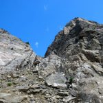
From here hop, skip, and jump over rocks toward the peak. There is a faint climbers trail heading up toward the prominent southwest couloir. This is the couloir on the left as you are looking at the peak. The climb up the couloir is a mix of large slabs, loose rock, and dirt. This route often holds snow late into the summer, so always use caution in this terrain. A fall here could be devastating.

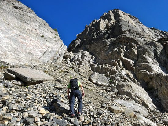
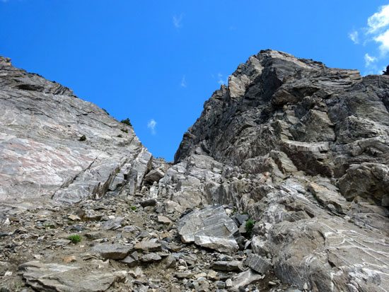
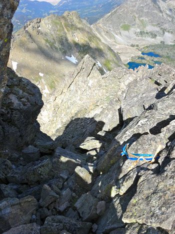
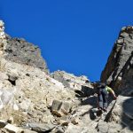
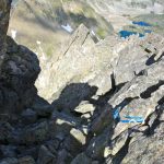
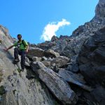
At the top of the couloir, there are two ascent options. An obvious chimney goes up from the col. This route is 5.2. We chose to walk a few step down the opposite side to a more open V-shaped upper couloir. This route is more of the same – loose rock scrambling.
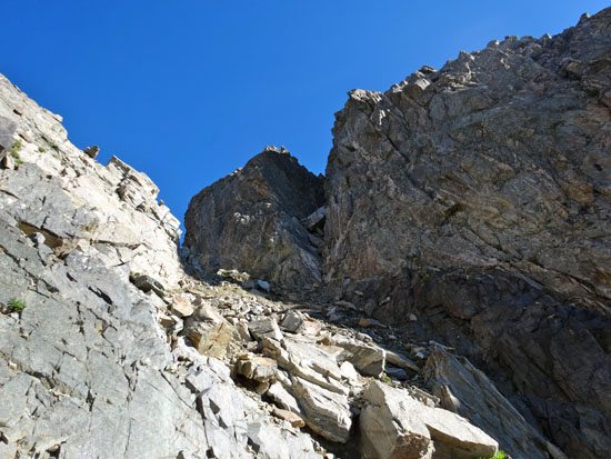
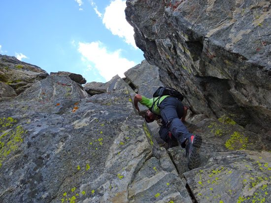
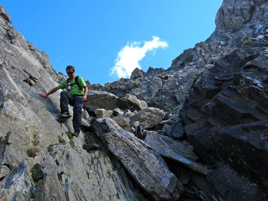
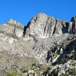
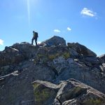
The top of this route could be considered the crux of the climb – a handful of fourth class moves to the summit. Jeremy and I reached the summit of Beehive Peak in 2.5 hours, 4.3 miles, and 2950′.
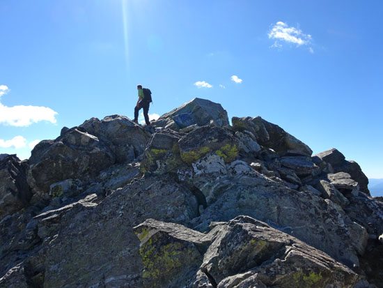
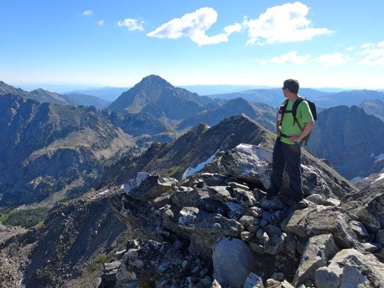
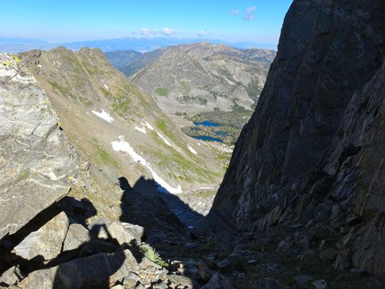
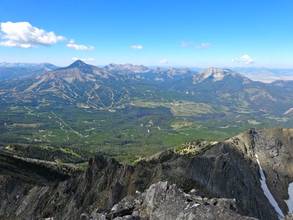
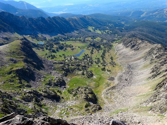
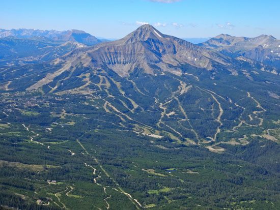
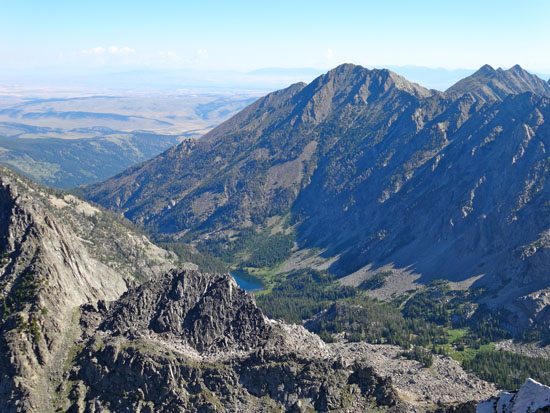
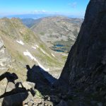
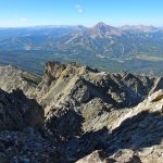
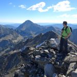
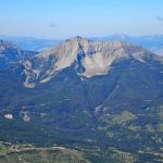
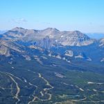
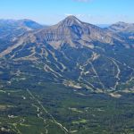
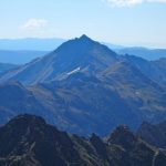
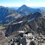
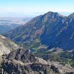
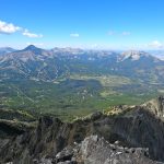
The summit is big enough to comfortably walk around, but there is extreme exposure on all sides so use caution. On the summit of Beehive Peak the world spreads out below. To the north lies Beehive Lake and the Spanish Lakes. Mirror Basin, Summit Lake, Gallatin Peak, Wilson Peak, and Beehive Basin are clearly visible. Lone Mountain, Cedar Mountain, and Fan Mountain take up the distance skyline. On the far horizon the vast and wild Taylor Hilgards can be seen. It’s unreal.

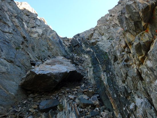
Finally it was time to head back to the car. We choose to down climb our ascent route. This is the standard down climb for most of the technical climbs on Beehive Peak. At the top of the 4th class section, there were numerous slings as many people choose to build an anchor and safely rappel. This is definitely the safest option so always bring a rope. We were okay with the risk and slowly and carefully climbed down. Besides a fall, loose rock is a big hazard so helmets are a good idea too. Always watch out for other groups climbing up the route below you.
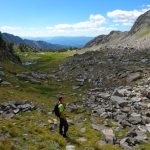
We scurried on down to the col and then down the couloir. Hopped along the rocks and followed the fall line down into the open meadows far below. It wasn’t long before we hit the trail.
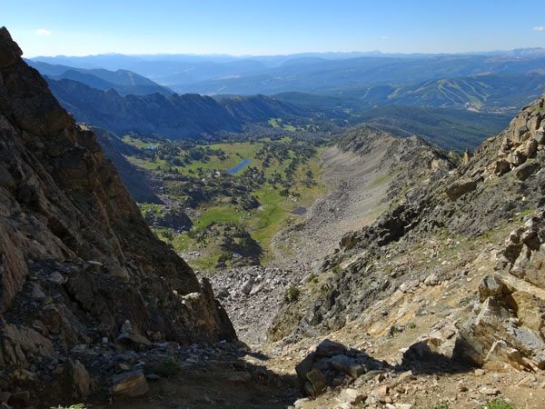

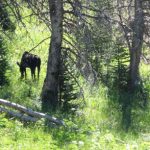
The walk out was uneventful. We saw lots of people (100+) and a moose. Soon we were back at the truck. Round trip our climb of Beehive Peak took a leisurely 4.75 hours. We traveled 8.5 miles and 3028 vertical feet. Plus, we were back in time for lunch. Good day indeed.
Watch panorama views from the summit of Beehive Peak:
View route of our climb of Beehive Peak on HillMap:
Additional photos from climbing Beehive Peak near Big Sky, Montana:


This trip report for climbing Beehive Peak in Montana’s Madison Range is from July 28, 2016.
#amountainjourney #madisonrange #bigsky #montana #eternalstoke #beehivebasin #beehivepeak


