
Hiking Imp Peak Via The South Ridge In Montana’s Madison Range
Location: Imp Peak, Taylor Hilgard Unit, Lee Metcalf Wilderness, Madison Range, Montana
Type: Peak
Rating: Grade 3-4 Class II
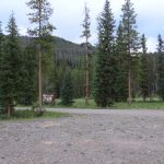
Trailhead: Upper Taylor Fork Trailhead – 7,250′
Distance: 17.80 miles
Time: 8 to 12 hours round trip
Elevation Imp peak: 11,202’+
Total Vertical: 4825′
Lat/Long: 44 59.5626 N, 111 27.2154 W
Maps: Koch Peak, Hilgard Peak, Lincoln Mountain
Find More Montana Trip Reports
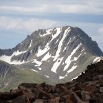
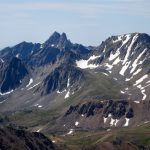
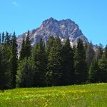
Imp Peak is a remote summit deep in the Taylor Hilgard Unit of the Lee Metcalf Wilderness in the Madison Range of Montana. It is the 4th highest peak in the range at 11,202′. There are two summits – East and West. The more mellow West summit of Imp Peak is labeled as 11,202′ on most maps, but the East summit is more rugged and definitely appears to be the higher of the two.


Imp Peak lies along the crest of the Madison Range. It’s south ridge acts as the border of the Beaverhead-Deerlodge National Forest/Gallatin National Forest. This peak an be accessed via Taylor, Alp, and Wolf drainages. Most people access Imp Peak from the Upper Taylor Fork Trailhead and hike in via the Taylor Creek or Lighting Creek to Alp Creek. However you approach, expect a long day or plan an overnight. And bring your bear spray.

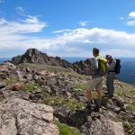
Ever since laying eyes on Imp Peak from the summit of Koch Peak, I’ve wanted to climb it. Finally, on a stunning July day, Kevin Chartier and I set off to climb Imp Peak. Our planned route was to park at the Upper Taylor Fork Trailhead (7250′). Then hike in via the Lighting Creek Trail #7, then follow the Alp Creek Trail #158 to Alp Lake, and then make a summit attempt via the South Ridge.

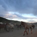
We pulled off of Highway 191 and on to the dirt Taylor Fork road around 6 AM. It was greybird and a bit drizzly. About halfway down the road, we were stopped by true #montanamoment – wranglers driving their horses down the road. An enjoyable site in the dawn light. We kept driving toward the Upper Taylor Fork Trailhead and as we approached, we ran into another hiker, Chris Rotar. Chris decided to join us for our Imp mission and we hit the trail.

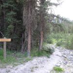
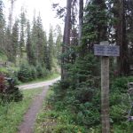
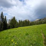
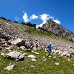
The trail is mellow through open meadows for about half a mile to where the Taylor Falls Trail #17 splits with the Lightning Creek Trail #7. We turned left and continued on the Lightning Creek Trail, which we stayed on for about 2.4 miles. Soon the trail hits private property. Please stay on the trail as there is a well marked easement through this area.


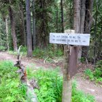
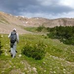
Shortly after the private property ends you’ll hit the Lee Metcalf Wilderness boundary and there is another trail split. Turn right on to the Alp Creek Trail #158 at approximately 7950′. The Alp Creek trail follows a few switchbacks and then mellows again as you approach Sedge Meadows in about 1.5 miles. Once you enter Sedge Meadows the trail crosses the creek and continues onwards toward the saddle between Pyramid Point and Point 9348. This trail is well trodden but is not marked on my maps.


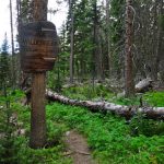
We did not cross the creek and followed a faint trail across the meadows toward Pyramid Point. At the far end in of the meadow in some old growth trees is an established horse camp. The trail continues on as it weaves through meadows and forests. It fades in and out, but it’s easy to track the horse prints that are en route to Alp Lake.

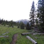
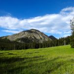
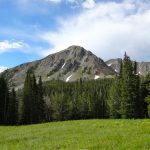
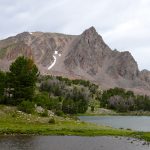
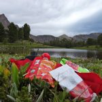
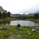
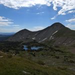
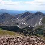
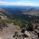
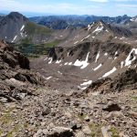
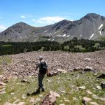
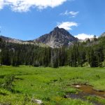
When we hit the wetlands at about 9100′ there seemed to be quite a few trails to follow. It seemed like all of them climbed steadily up toward Alp Lake at about 9700′. We reached Alp Lake in about 3 hours and 7.65 miles. It’s a stunning place to enjoy a snack and a drink of water.


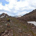
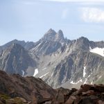
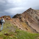
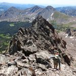
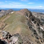
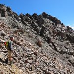
From Alp Lake we worked up to the south ridge of Imp Peak. The trail was long gone and we scrambled over rocks to the ridge line. A few lingering patches of snow lingered on the north facing slopes.


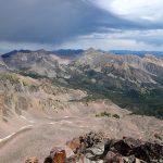
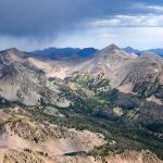
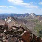
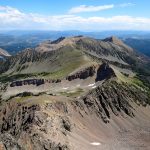
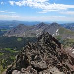
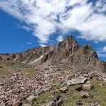
At the ridge line we were greeted with expansive views of SW Montana, Yellowstone, and down to the Tetons. Stunning. And the views got better as we continued up.


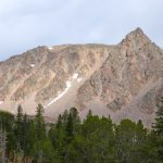
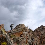
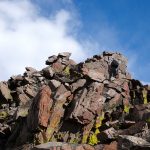
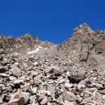
Following the ridge was a fantastic adventure. It was simple ridge walk/scramble/climb. Discussion amongst our crew determined that the south Ridge would be a class 3 to 4 climb. There may be one or two fourth class moves near the top, but no ropes are required, just sure-footing above a bit of exposure.


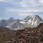
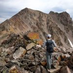
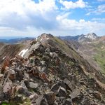
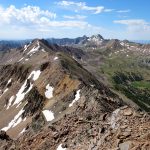
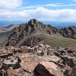
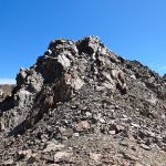
We soon reached the West summit. It had taken 4 hours, 40 minutes, 9.25 miles, and 4325′. The west summit is marked as 11,202′ on most maps. We enjoyed a snack while looking over at the East Summit. This more prominent horn appears taller so we crossed the broad ridge and climb it too. The East Summit is definitely more rugged and is covered in loose rock and choss. It’s still an easy climb, but watch for falling rocks.


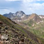
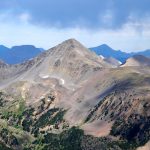
Both summits offer mind blowing views. It’s unreal out here. The entire range spreads out in all direction – Echo, Koch, Hilgard, Woodward, Sentinel, Pyramid, Peak 10930, and the Monuments and Spanish Peaks in the distance. It’s endless.


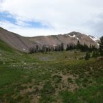
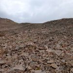
To get back to the car we decided to continue down the more direct South Couloir instead of returning via our ascent route. The South Couloir is a mix of loose scree, softball size ankle busters, massive boulders, and silver surfers. We took our time and soon made it back to flatter ground. We then used GAIA GPS to guide us back to the trail.


We rock hopped and scooted down two steep moraines before we re joined our track near the wetlands at 9100′. Then we boogied on down the trail on the old heel-toe express. Near Sedge Meadows we ran into another group of hikers who politely informed us that we had left our car doors opens at the Trailhead all day. Isn’t that always the problem with alpine starts! We always forget something. Haha.


We hurried back down the trail as we were all eager to get back at this point. We followed the trail the same way we had come in. It had been a big day. We returned to the car in 9.25 hours, 17.8 miles, and 4825 vertical feet. Well worth it.

Watch panorama views from both the East and West summits of Imp Peak:
View route of our hike to Imp Peak on HillMap:
Additional photos from hiking Imp Peak:
This trip report for hiking Imp Peak in Montana’s Madison Range is from July 22, 2016.
#amountainjourney #madisonrange #bigsky #montana #imppeak


