
How’s your winter been so far? The snowpack is looking pretty decent across the Western US. While the first part of February has been relatively dry, stability has begun to improve in some regions and it might be time to start dabbling in to bigger terrain. Just make sure you know before you go.
Let’s take a look at the snow data for the western US compared to normal. Below is the Westwide SNOTEL Current Snow Water Equivalent % of Normal as of February 15, 2016. You can link to the most recent data from the USDA’s Natural Resources Conservation Service here. It’s updated regularly.
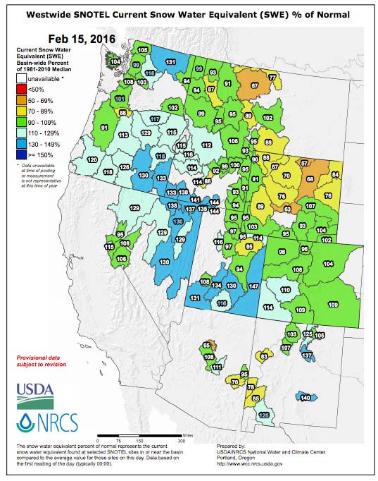
As you can see the maritime snowpack is thick and more snow is in the forecast. The northern rockies of MT and WY are a bit below average, but still skiing great. On a whole the mountain west gets two thumbs up. See how this month compares to past months in our past Snotel posts.
SnoTel data is one of the best ways to find out where the snowpack is deep and the coverage is above average. Are you ready to plan your next skiing adventure?
Enjoy the snow. Be safe out there.


