
Hiking Sphinx Mountain in the Madison Range of Montana
Type: Peak
Rating: Grade II, Class 3
Distance: 14 miles
Total Vertical: 4550′
Time: 8 hours
Trailhead Elevation: 6240′
Helmet Pass Elevation: 9,000′
Sphinx Mountain Elevation: 10876′
USGS Maps: Sphinx Mountain, Lake Cameron
Read the Trip Report for Skiing The Sphinx.
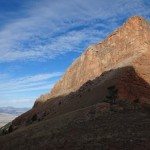
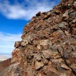
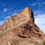
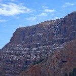
Sphinx Mountain is a fortress of reddish conglomerate deep in the Madison Range. Its steep vertical drop plummets thousands of feet into a well-known grizzly bear stronghold. Steep walls of alpine ice line its northern flanks. Endless wilderness fans out on the eastern and southern aspects. On the western side of Sphinx Mountain, a steep gully filled with conglomerate formations, loose scree fields, and pockets of year-round snow offer an adventurous route to a stunning summit at 10876′.

Sphinx Mountain is a highly visible peak because it is isolated from the rest of the range by Bear Creek and Indian Creek. It towers over highway 287 near Ennis and Cameron. It peaks its head out when driving down highway 191 or biking through the Big Sky Town Center. It punctuates the southern skyline when you unload the tram at the top of Lone Mountain. It is even featured on the Big Sky Resort Trail Map.
Located in the 141,000 acres of the Taylor Hilgard Unit of the Lee Metcalf Wilderness, which is in the Beaverhead-Deerlodge National Forest of southwest Montana, Sphinx Mountain towers over the surrounding wilderness. It’s a popular summit at 10876′ and can easily be climbed in a day trip by a fit hiker.

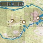
On a lucky Thursday in October, Justin Howells and I decided to climb Sphinx Mountain. Our plan for the day consisted of heading up Trail Fork to the Helmet Pass, summiting the Sphinx via the western gully, and returning to the Bear Creek Trailhead by traveling around Black Mountain (9653′) through the Bear Creek Wildlife Management Area via the Middle Fork of Bear Creek. We figured the day would consist of approximately 13.5 miles and 4600′ vertical.
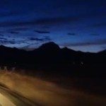
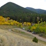
This is our adventure to Sphinx Mountain… We left Big Sky in the dark and headed to the Madison Valley. Cruising south on highway 287, the headlights hit the USFS turnoff for Bear Creek near Cameron, MT. We turned east and followed a dirt road through range land toward the Bear Creek Trailhead.

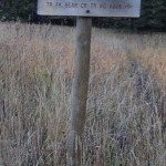
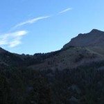
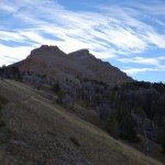
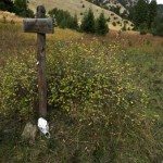
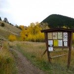
The Sphinx and it’s sidekick, the Helmet were beautifully silhouetted with the rising sun as we neared the trailhead. We parked next to the Bear Creek Ranger Station at 6240′. We quickly geared up for a long day hike to the summit of Sphinx Mountain. After checking the USFS trailhead sign, we uneasily read a warning of wounded grizzly bear in the area. With a bit of hesitation we began our hike east on Trail Fork #326.


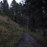
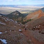
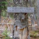
Without any hesitation we jumped right into bear aware tactics. Constant “hey bears,” “Ay-O’s”, and “koooo-wheee” echoed through the box canyon – not a place where we wanted to encounter a grizzly bear. Within 10 minutes, we saw a large vertebrae in the middle of the trail and stepped up the pace. After 1.8 miles, the trail splits in an open meadow. With a bit more light and the ability to see, we turned left on Trail 357 toward Helmet Pass.

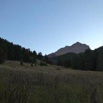
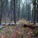
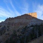
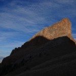
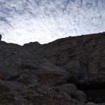
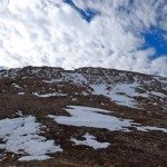
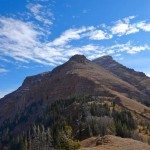
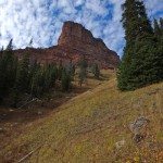
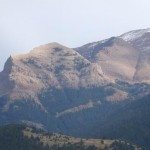
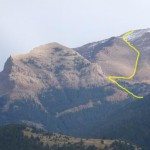
The trail works across a meadow. It then switchbacks through forests steadily gaining elevation. As we approached Helmet Pass at approximately 9,000 feet, the sun was just hitting the Helmet. The Helmet is a beautiful triangular rock formations with vertical walls stretching 100’s of feet above the pass. Mountain goats relaxed on its southern flanks as the sun hit the summit of the Helmet at 9653′. It took approximately 2 hours and 4.85 miles to reach the saddle.

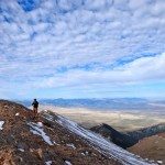
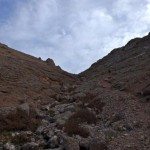
After a quick refueling stop, we headed east on an established climber’s trail. The trail climbs the western aspect of Sphinx Mountain. It was relatively easy to follow and has obviously been used by countless climbers. The trail treads over loose scree, around conglomerate faces, and heads consistently uphill. Pockets of snow and grassy tundra increased as we approached the summit. With a final class 3 push, we reached 10867′ and the summit of Sphinx Mountain – 3 hours 15 minutes from the trailhead.

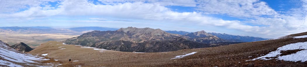

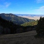
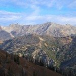
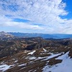
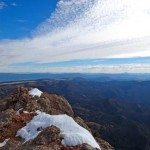
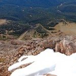
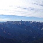
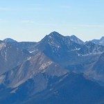
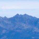
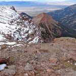
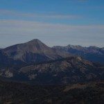
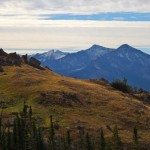
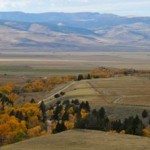
As you can imagine the views were outstanding. The entire Madison Range stood out. Cedar Mountain, Lone Mountain, Big Sky, and the Spanish Peaks dominated the northern skyline. The Gallatin Range and distance peaks of the Absorakas and Beartooths were easily visible to the east. The remote Taylor Hilgard Range stood out to the south. A hazy outline of the Tetons was visible in the far distance. The Madison River and Valley meandered far below. The view alone was worth it. The PeakFinder app helped us determine the names of distinct peaks.


Inspired by the views, we explored Sphinx Mountain. An authentic prayer stick caught our attention and we scrambled north to check it. (There are no photos of this because legend claims it will bring you 10 days of diarrhea). We headed a bit farther north to try to get a glimpse of the legendary north face of Sphinx Mountain.

The north face of Sphinx Mountain is known for its outstanding ice climbing routes like the Earl-Trimble, The Riddle, and the Lowe Direct. We were more intrigued by the ski descent of the Lowe Route by Hans Saari and Kris Erickson called the Sphinxter. For the majority of skiers, the western gully is the standard ski route on Sphinx Mountain.

Eventually we headed back down the western aspect of Sphinx Mountain via our ascent route. We returned to Helmet Pass noting that we had traveled 8.1 miles at this point. At the col, we refueled again, found the trail, and headed north to complete our loop.


The trail switchbacks down toward the Middle Fork of Bear Creek. The early season ice on the north face of Sphinx Mountain is inspiring and the rock of the Helmet is beckoning, but we were heading back to the trailhead.


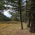
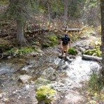
After the switchbacks, the trail works through the deep forests of the Lee Metcalf Wilderness. In 1.1 miles, the trail intersects Trail 325. Head west and follow the trail for 3.6 miles. In this section we saw giant moose prints, but our constant bear calls kept the grizzly bears away. There are four stream crossings and only one has a bridge. The crossings can be dangerous early season due to snow melt, but they were only ankle deep in October. Plan on getting your feet wet. We certainly did.

The terrain eventually opens up. The trail splits one more time as you exit the drainage. Head south for the last mile. The final push crosses rolling meadows with outstanding views of the Madison valley. Finally, it drops you back into the Bear Creek Trailhead and parking lot.


After a long day, we were both sore. For our trip to the summit of Sphinx Mountain, we traveled a total 14.3 miles and 4850 vertical feet in 7 hours and 45 minutes. We did not encounter any wounded grizzly bears. Overall, it was a fantastic day. Climbing Sphinx Mountain should be on everyone’s bucket list. Time to head to the Gravel Bar in Ennis for the Sphinx Burger.

On another climb of Sphinx Mountain, I captured this YouTube summit Panorama. Enjoy.
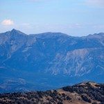
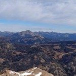
Here are some additional images from hiking Sphinx Mountain in the Madison Range:


