
Hiking Woodward Mountain In Montana’s Madison Range From East To West
Location: Woodward Mountain, Madison Range, Montana
Type: Peak
Rating: Grade II Class 2
Trailhead: Upper Taylor Fork Trailhead – 7,250′
Distance: 10.35
Time: 5 to 8 hours round trip
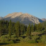
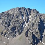
Woodward Mountain Elevation: 10,659′
Total Vertical: 3700
Lat/Long: 45°00′34″N 111°24′51″W
Maps: Koch Peak, Lincoln Mountain
Find More Montana Trip Reports
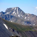
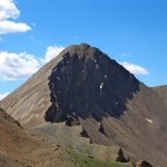
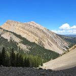
Woodward Mountain is a beautiful mountain located on the Lee Metcalf Wilderness boundary in the Madison Range of Montana. The peak sits at 10,659′ near the junction of Lightning Creek and Taylor Creek. This peak is clearly visible as your 4×4 vehicle drives down the Taylor Fork Road toward the Upper Taylor Fork Trailhead.

On a sunny July day, Jeremy Wood and I decided to climb Woodward Mountain. There is no defined or standard route up to the top of Woodward Mountain. Pretty much every route is a scramble. Based on map research and limited beta our plan was to head up Lightning Creek, climb the East Face, tag the summit, down climb the west face to the north drainage and head out the Taylor Creek trail – basically a loop that traverses the peak. Here’s our trip report.

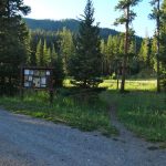
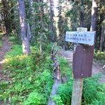
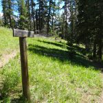
We parked at the Upper Taylor Fork Trailhead at 7,250′ and hit the trail in the early morning light. We quickly walked up the Taylor Creek Trail #17 for half a mile. At the first trail junction, we turned on to Lightning Creek Trail #7.

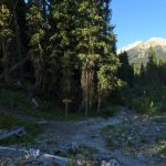
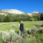
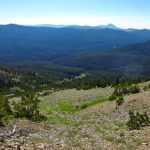
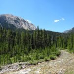
The Lightning Creek trail weaves through the forests and crosses a large parcel of private land. Be respectful and stay on the trail at all times. It’s well marked. After another 2.3 miles we turned on to the Alp Creek Trail #158. The trail crosses a creek and gains a bit of elevation. Soon we entered the Lee Metcalf Wilderness. Shortly after we popped out into a wide open meadow. This was about 3.9 miles down the trail around 8325′ in elevation.

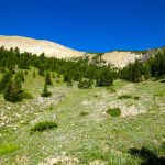
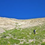
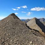
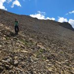
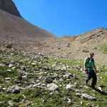
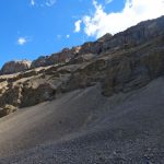
From here we turned west and started hiking up the East face of Woodward Mountain. The hiking was easy as we moved steadily uphill through wide open meadows filled with rocks, wildflowers, and trees. We continued upwards toward the ridge line. The final approach to the ridge had lots of loose rock and was a bit challenging, but we soon made it to the ridge.


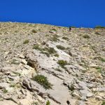
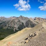
A few mountain goats played on the rock covered slopes and we continued putting one foot in front of the other toward the summit of Woodward Mountain. The rock is very sharp and would eat up a dog’s paws.


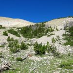
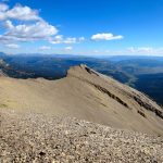
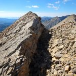
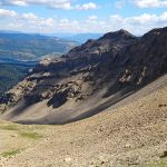
The final push is steep but wide open, and then it narrows into blocky slabs with precipitous drops off to the west side all the way to the summit. It seems that the entire mountain could fall down into the enormous cirque thousands of feet below at any moment. We reached the summit in 3.25 hours after covering 5.25 miles and 3525′.


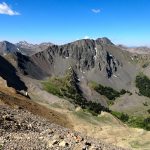
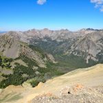
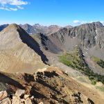
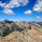
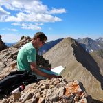
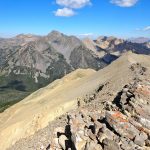
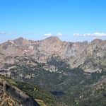
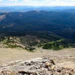
After a few moments on the summit of Woodward Mountain at 10,659′ we found a place to sit down and enjoy the views. Wow. Koch Peak, Tunnel Ridge, Peak 10809, the Taylor Fork, and beyond. Echo, Hilgard, Imp, and the Spanish Peaks lay in the distance.


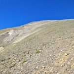
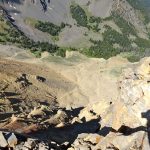
With strong LTE signal at the summit, we consulted GAIA GPS and finalized our plan to descend Woodward Mountain via the west face and into the Northernmost drainage down to Taylor Creek.

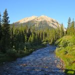
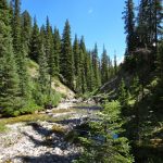
The steep western face was covered in loose and inconsistent sharp scree. At approximately 10,000′ we headed north and walked down a stunning and mellow drainage below colorful limestone. We hung on the far right side of the drainage walking on loose rock and relied on GAIA to navigate back toward Taylor Creek. I would not recommend ascending this side of the mountain, but you could do it.


We crossed the Taylor Creek at 8000′ and scrambled up to Trail #17. We reached this point in 5.25 hours and 7.3 miles. From here it was smooth sailing on the trail back to the car. There was one last wet crossing of the Taylor Creek before we hit the junction of Trail 17 and 7 again. A few short minutes later and we were back at the car. Another peak in the bag.


Round trip our east to west traverse of Woodward Mountain in Montana took 6.25 hours. We covered 10.35 miles and 3701′. The views from the top were well worth it.
Watch panorama views from the summit of Woodward Mountain:
View route of our hike to Woodward Mountain on HillMap:
Additional photos from hiking Woodward Mountain:
This trip report for hiking Woodward Mountain in Montana’s Madison Range is from July 29, 2016.
#amountainjourney #madisonrange #bigsky #montana #eternalstoke #woodwardmountain


