
Do you know how many biosphere reserves are located in the United States? As of September 2018, the World Network of Biosphere Reserves consists of 686 biosphere reserves in 122 countries – including 20 transboundary sites. Of that total, there are 29 biosphere reserves in the United States.
Biosphere Reserves are internationally protected areas designated by UNESCO. The UNESCO World Network of Biosphere Reserves recognizes a dynamic network of unique ecosystems around the world. The goal of biosphere reserves is to promote research, education, conservation, development, and sustainability.
For an area to qualify as a biosphere reserve, the site is nominated by a national government and they “remain under the sovereign jurisdiction of the states where they are located.” After being nominated, a potential biosphere reserve must meet a variety of characteristics which can be found here. Once qualified, the biosphere reserves are internationally recognized.
This post focuses on the biosphere reserves in the United States as of September 2018. The list of biosphere reserves ebbs and flows each year as sites are added and withdrawn.
Now let’s take a look at the 29 biosphere reserves in the United States:
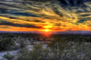
Big Bend
- Year Designated: 1976
- Area: 283,247 hectares
Cascade Head
- Year Designated: 1976
- Area: 7,051 hectares
Channel Islands
- Year Designated: 1976
- Area: 479,652 hectares
Denali
- Year Designated: 1976
- Area: 782,000 hectares
Everglades & Dry Tortugas
- Year Designated: 1976
- Area: 636,411 hectares
Crown Of The Continent
- Year Designated: 1976
- Area: 410,056 hectares
Jornada
- Year Designated: 1976
- Area: 78,297 hectares
Luquillo
- Year Designated: 1976
- Area: 3,487 hectares
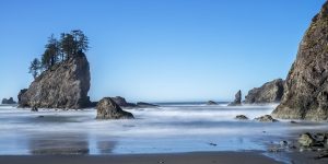
Olympic
- Year Designated: 1976
- Area: 373,396 hectares
Organ Pipe Cactus
- Year Designated: 1976
- Area: 133,882 hectares
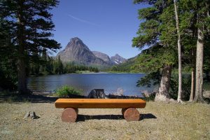
Rocky Mountain
- Year Designated: 1976
- Area: 106,710 hectares
San Joaquin
- Year Designated: 1976
- Area: 1,832 hectares
Sequoia-Kings Canyon
- Year Designated: 1976
- Area: 349,543 hectares

Yellowstone-Grand Teton
- Year Designated: 1976
- Area: 898,349 hectares
University of Michigan Biological Station
- Year Designated: 1979
- Area: 4,048 hectares
Virginia Coast
- Year Designated: 1979
- Area: 13,511 hectares
Hawaiian Islands
- Year Designated: 1980
- Area: 99,545 hectares
Isle Royale
- Year Designated: 1980
- Area: 231,399 hectares
Big Thicket
- Year Designated: 1981
- Area: 39,121 hectares
Guanica
- Year Designated: 1981
- Area: 4,000 hectares
Central Gulf Coast Plain
- Year Designated: 1983
- Area: 16,402 hectares
South Atlantic Coastal Plain
- Year Designated: 1983
- Area: 8,222 hectares
Mojave and Colorado Deserts
- Year Designated: 1984
- Area: 2,388 hectares
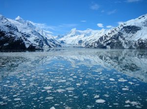
Glacier Bay-Admiralty Island
- Year Designated: 1986
- Area: 1,515,015 hectares
Golden Gate
- Year Designated: 1988
- Area: 212,022 hectares
New Jersey Pinelands
- Year Designated: 1988
- Area: 438,210 hectares
Southern Appalachian
- Year Designated: 1988
- Area: 14,960,000 hectares
Champlain-Adirondack
- Year Designated: 1989
- Area: 3,990,000 hectares
Mammoth Cave Area
- Year Designated: 1990
- Area: 367,979 hectares
The following 18 Biosphere Reserves in the United States were withdrawn from the official database:
- Aleutian Islands – 1976 to 2017
- Beaver Creek – 1976 to 2017
- Central Plains – 1976 to 2017
- Coram – 1976 to 2017
- Desert – 1976 to 2017
- Fraser – 1976 to 2017
- H.J. Andrews – 1976 to 2017
- Hubbard Brook – 1976 to 2017
- Neatak – 1976 to 2017
- San Dimas – 1976 to 2017
- Stanislas Tuolumne – 1976 to 2017
- Three Sisters – 1976 to 2017
- Virgin Islands – 1976 to 2017
- Kenza Praire – 1978 to 2017
- Niwot Ridge – 1979 to 2017
- California Coast Ranges – 1983 to 2017
- Carolinian South Atlantic – 1986 to 2017
- Land Between The Lakes – 1991 to 2017
Below you will find a map of the Biosphere Reserves in the United States:
Filter by
***We do not guarantee accuracy of the markers in the above map. It is hard to pinpoint exact locations and some biosphere reserves are situated in multiple locations.
To learn more about UNESCO Biosphere Reserves and to find lists of biosphere reserves in other regions, go to UNESCO.org.


