
Winter is coming. The storms are starting to roll in with regular frequency. The mountains are turning white and the snow line is creeping lower almost daily. Resorts are blowing snow and starting to open. Some folks are starting to make turns in the backcountry. It’s time to start thinking about winter.
Let’s take a look at the snow data for the western US compared to normal. Below is theWestwide SNOTEL Current Snow Water Equivalent % of Normal as of November 2, 2015. You can link to the most recent data from the USDA’s Natural Resources Conservation Service here. It’s updated regularly.
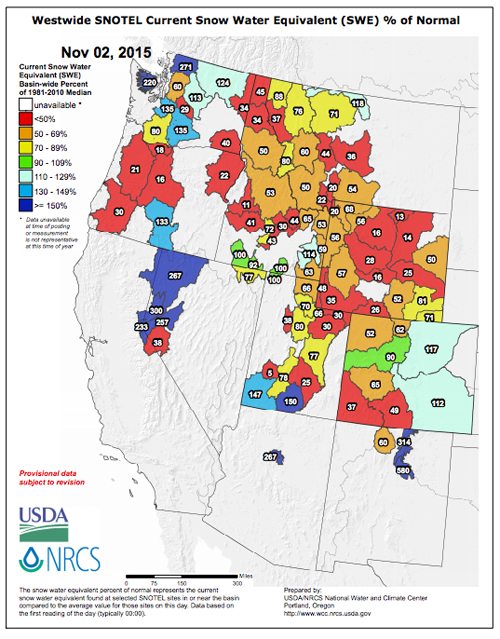
Watch the weather and tune in regularly to see where the snowpack is deep. It’s starting to fill in across the Mountain West. Exciting! These maps are often the inspiration of epic skiing road trips.
See you in the mountains.


