
Climbing Gallatin Peak in the Spanish Peaks Near Big Sky, Montana
Location: Gallatin Peak, Spanish Peaks, Lee Metcalf Wilderness, Madison Range, Montana
Type: Peak
Rating: Grade III Class 3
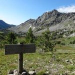
Trailhead: Lower North Fork (7,250′)
Distance: 21 miles
Time: 9 to 14 hours
Elevation Gallatin Peak: 11,015′ | 3357 meters
Total Vertical: 6,000′
Lat/Long: N45.36826° , W111.36579°
Maps: Gallatin Peak, Lone Mountain
____________________________________
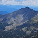
Gallatin Peak is the highest peak in the Spanish Peaks Unit of the Lee Metcalf Wilderness in the Madison Range of Montana. At 11,015′, Gallatin Peak towers above the surrounding landscape beckoning to be climbed (and skied).

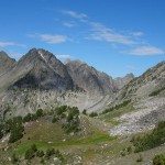
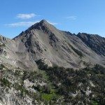
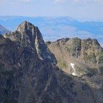
Gallatin Peak is a rowdy mountain. It’s sharp summit was carved by glaciers millions of years ago leaving a mountaineering gem smack dab in the middle of a wilderness area. Prominent ridges divide the peak into exciting terrain – the north face is riddled with couloirs, the west face has a prominent couloir that runs for several thousand feet, the wide open south face glows in the rays of the sun, and the vast east face drops down in to hidden valleys. The skiing potential is insane and the hiking/climbing is superb. It’s an incredible peak.
Surrounded by rugged terrain, Gallatin Peak is hard to access. Few people venture to its slopes or its summit. Even though it is highly visible from Big Sky Resort, the Gallatin Valley, and beyond, Gallatin Peak has a unique wilderness feel that other summits lack.

Pull out your Beartooth Publishing Map and you’ll see that there are many different ways to access Gallatin Peak. Pick a trailhead – Hellroaring, Indian Ridge, Spanish Creek, Beehive, North Fork – and you’ll find trails that meander through the wilderness toward Gallatin Peak. However you access Gallatin Peak, get ready for a big day.
Based on my location, research, and local knowledge, I think that the easiest way to reach the summit of Gallatin Peak is via the Lower North Fork Trailhead in Big Sky. In Turiano’s Select Peaks, he suggests leaving from the upper Beehive Trailhead. Due to private land issues and gated communities in the Big Sky area, this option is unrealistic.
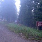
This is why Jeremy Wood and I decided to access Gallatin Peak via the Lower North Fork trailhead with the goal of climbing the south face of Gallatin Peak in a day. Many people do this as an overnight mission, but we opted not to. The day started with a cup of coffee as the sun rose over a thick inversion that covered the town. Luckily, the clouds broke near the trailhead at 7,250 feet and we were walking down the trail around 6:45 am.

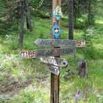
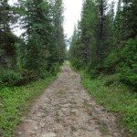
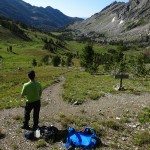
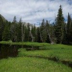
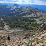
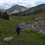
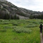
The North Fork trail is a double wide trail that is heavily used by Lone Mountain Ranch. It crosses private land at the base of Yellow Mountain and parallels the North Fork toward Bear Basin. After about 3 miles, you reach a junction where the trail from Beehive intersects the North Fork Trail. The trail continues through the forest crisscrossing several streams before it opens up into the alpine terrain of Bear Basin.


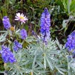
In July, Bear Basin is filled with wildflowers, a few lingering patches of snow, and stunning terrain. Passing notable ski lines, like the Bat Ears Couloir made us dream of snow. Is it winter yet?

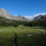
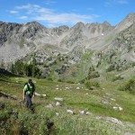
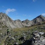
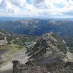
After about 2200 vertical feet and a total of about 7 miles, the trail intersects another trail near the saddle at the head of Bear Basin. If you go up and over the saddle, you can access Mirror Basin or head onwards to Summit Lake. Our route took us the opposite direction – toward the ridge between Bear Basin and Hellroaring Basin.


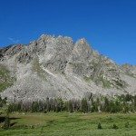
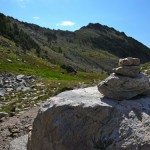
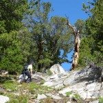
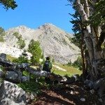
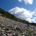
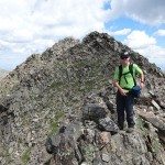
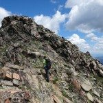
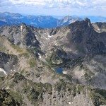
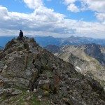
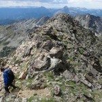
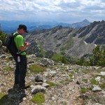
This section of trail is not especially well maintained. The trail was hard to follow, but some lucky soul build cairns at regular intervals to keep wanderers like me on track. Three and a half hours and 2975 vertical feet after leaving the car, we reached the ridge line at about 10,000 feet, and laid eyes on our objective, the south face of Gallatin Peak.


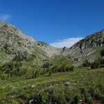
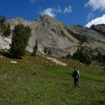
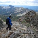
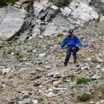
There’s potential to drop down the steep terrain and beeline it toward the peak, but we opted to continue on the trail as it headed away from the peak and switchbacked down a ridge line for about 1,000 feet. When we reached 9,000 feet in elevation we turned off trail and made our way cross country.

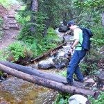
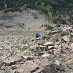
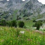
This terrain was a bit marshy and our boots made the sound of sucking salamanders as we crossed the Hellroaring basin. Eventually the marshy terrain turned into meadows of lupine and other wildflowers amongst ancient marbled granite deposits before we reached the scree and talus slopes of Gallatin Peak.


The loose rock covering the south face of Gallatin Peak made for slow and sometimes frustrating climbing – one step up, half a step back down. We slowly and steadily made our way up a small tree covered rib toward the summit.


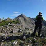
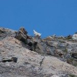
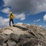
As we neared the top, the loose talus and scree, turned into larger boulders and more stable footholds. A family of mountain goats played on the summit’s flanks as we traversed the ridgeline toward the high point. Finally after 5.5 hours, 11 miles, and 4885 vertical feet we were on the summit of Gallatin Peak.


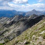
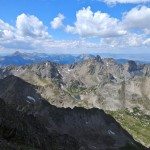
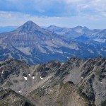
There’s nothing like standing on a prominent summit with 360 degrees of jaw dropping views. There were lakes – Summit Lake, Chilled Lakes, Grace Lakes; distant peaks – Wilson Peak, Jumbo Peak, Garnet Mountain, Lone Mountain, Fan Mountain, Blaze Mountain, Storm Castle, Beacon Point; distant ranges – Bridgers, Crazies, Taylor Hilgards, Tobacco Roots, Gallatins; massive valleys – Gallatin Valley, Madison Valley, Yellowstone National Park; and snowless ski lines – Peruvian Face, Hanging Garden, and other unnamed couloirs that are now on my tick list. I love the mountains!


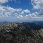
Light clouds created shadows that danced over the rugged terrain as we ate snacks and made plans for future missions. But we were also only half way done with our day. It’s time to head back via the route we had come.


We played a delicate balance game as we plunge stepped down the scree back to the base. What had taken us just over an hour to climb, only took 20 minutes to go back down. We scurried across the Hellroaring Basin as our boots squished through the moist wilderness.


The trail back to Bear Basin was easy to find. Setting a slow and steady pace we gained our final major ascent of the day (1,000′) in about a half hour. At the top, of the ridge we noticed the sky was darkening for Montana’s daily, scheduled afternoon thunderstorm. Glad we weren’t on the summit anymore!

Before we made our way back down Bear Basin, we shot off a few quick texts to ensure we were safe from our wilderness adventure while we still had cell service. We soon lost the hard-to-follow trail and ended up cross country toward the Basin floor where we intersected the Bear Basin trail.

Only stopping for water, we made excellent time back toward the car. A flurry of raindrops helped speed our descent. The wide road of the North Fork trail was a welcome sight for my tired and clumsy legs – until the final half mile, which is slightly uphill.


Just before 5pm, we were back at the car. Car-to-car our adventure to climb Gallatin Peak took us 10 hours. We covered 21 miles and 6,000 vertical feet. We were beat. So we did what anyone else would do, we headed to the Beehive Basin Brewery in Big Sky Town Center to have a beer or three.

____________________________________
View our route on HillMap:
____________________________________
Additional photos from our hike to Gallatin Peak:


____________________________________
This trip report for hiking Gallatin Peak is from July 24, 2015.


