
Hiking Mount Blackmore In The Gallatin Range of Montana
Location: Hyalite Canyon, Gallatin Range
Grade: I Class 1
Type: Out and Back Trail
Trailhead: Hyalite Day Use Area, Blackmore Trailhead
Distance: 12 miles round trip
Time: 6-7 hours round trip
Trailhead Elevation: 6720′
Mount Blackmore Elevation: 10,154′
Total Vertical Gain: 3700′
Maps: USGS – Fridley Peak, Mount Blackmore, Beartooth Publishing – Bozeman Area

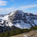
Mount Blackmore stands at 10,154′ in the heart of Montana’s Gallatin Range. It’s easily accessible from Hyalite Canyon near Bozeman via a well maintained trail that make for easy walking all the way to the peak. The round trip hike to the summit and back covers just under 12 miles and 3700′ vertical feet. It can be completed in about 6 hours.
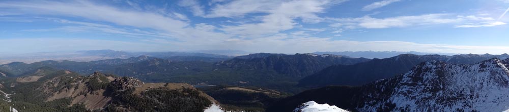
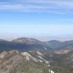
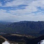
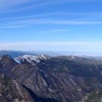
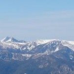
The views from Mount Blackmore are outstanding. At 10,154′, a sea of endless mountains stretches out in front of you. The vast Bozeman Valley, the Gallatin Range, Bridgers, Crazies, Hilgards, Spanish Peaks, Tobacco Roots, Absarokas, and other distant mountain ranges are all visible. From the summit of Blackmore, the stunning wildness of SW Montana is impressive.


Mount Blackmore is a volcanic peak that is approximately 55 million years old. In the late 1800’s it was finally named after Mary Blackmore – a British heiress who died in Bozeman. For as long as people have been in the Bozeman area, Mount Blackmore has stood tall as an iconic peak who’s alpine terrain and summit are highly visible from across the Bozeman area.
Besides the distance and the vertical gain, the hike to Mount Blackmore is an easy walk. No technical skills are required to reach the summit. Only endurance and bear spray are needed. Mount Blackmore is located in the heart of bear country. Be sure to adopt bear aware tactics as a way of life in SW Montana.

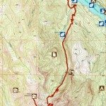
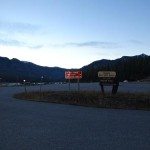
Andy “Catfish” Tenny and I decided to summit Mount Blackmore on a late Autumn day. Since mountains are best enjoyed in the morning, we left Bozeman as the sun began to hit town. We headed toward the Hyalite Canyon turn off and drove 10.5 miles to the Hyalite Day Use Area directly next to the Hyalite Reservoir on the west side of the dam. Hyalite Reservoir sits at the eastern base of Mount Blackmore and this is where the adventure begins.

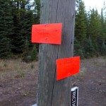
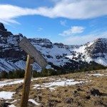
When leaving the parking area, there is a maze of trails where it is easy to get lost. This combined with the current tech savvy, neon, handwritten trail signs, it took longer than planned to join up with the Blackmore Trail, #423. Don’t worry, I’m sure the USFS will eventually upgrade their signage if they have the funds.

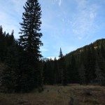
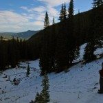
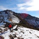
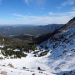
Once on the proper trail, it’s obvious where to go. The trail leads you through the forests of the Gallatin Range. It heads steadily uphill, switchbacking through thick forests which offer minimal views.


After 1.7 miles, you reach Blackmore Lake. Many people head to the lake for a short and sweet day hike, but Blackmore Lake was more of a pitiful puddle compared to other impressive lakes in the area. (Try Golden Trout or Lava Lake to see a real lake!)

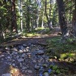
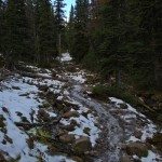
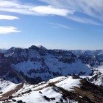
Beyond the lake, the trail ramps uphill and parallels Blackmore Creek. After a few frozen sections of trail, we hit the snow line at approximately 8800′. It was surprising how much snow there was for October.

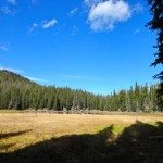
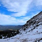
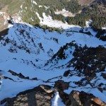
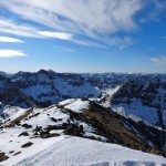
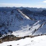
The trail continues through several open meadows and eventually pops out into a large cirque, which appeared to be an excellent ski destination. It is also the first real view of Mount Blackmore and it’s neighbor, Elephant Mountain.
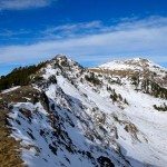
Switchbacking up the steep headwall on the north face of Elephant Mountain through deep drifts of early autumn snow made for slow travel. Eventually, the trail hits the col between Blackmore and Elephant at 9650′. Here the trail splits. One leads to the summit of Mount Blackmore and the other leads down the Cottonwood Drainage.

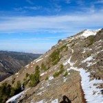
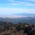
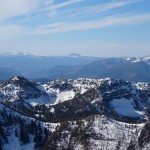
From this saddle, the Hellmouth Couloir on Alex Lowe Peak, the Ribbon on the NW face of Elephant Mountain, and views toward Hyalite Canyon are impressive, but they soon will get even better. It’s approximately one mile along the ridge line to the summit of Mount Blackmore from the fork in the trail.


The mellow ridge walk is easy travel and you will quickly gain the summit of Mount Blackmore at 10,154′. The views are incredible. Of note are Alex Lowe Peak, Hyalite Canyon, Gallatin Peak, Sphinx, Bozeman, Spanish Peaks, the distant Absarokas, and beyond. The north face of Blackmore looks like a fun ski too. It’s 360 degrees of impressive.


After soaking in the views and munching on some trail mix, the route back to the car is the same as the ascent route. Head back on the same trail. As the day gets later, you’ll see a steady stream of hikers coming up the trail – all heading up to enjoy the views and summit the peak they see from town each day.
Round trip, the adventure to Blackmore covered 11.8 miles, 3700 vertical feet, and took about 5.5 hours. That includes slow, snow travel in late Spring or early Autumn. It’s a non-technical, easy walk that is well worth the distance and vertical. It can easily be done in a pair of approach shoes. Be sure to bring your camera as the views are outstanding. Mount Blackmore is definitely one to check off your list.
Here are some additional photos from hiking Mount Blackmore in Hyalite Canyon:


This trip report for hiking Mount Blackmore was summited on October 18, 2014.


