
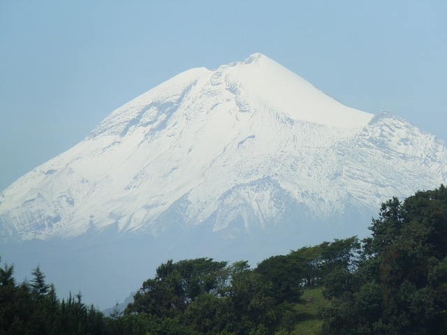
Do you know any interesting facts about Pico de Orizaba, Mexico? At 18,491 feet | 5636 meters, Pico de Orizaba, which is also commonly called Citlaltépetl, is the highest point in Mexico. This stunning stratovolcano dominates the skyline is a popular destination for mountain enthusiasts.
Pico de Orizaba, Mexico Quick Facts:
- Elevation: 18,491 feet | 5636 meters
- Prominence: 16,148 feet | 4922 meters
- Isolation: 1671.58 miles | 2690.14 kilometers
- Lat/Long: 19.030498, -97.269848
- Range: Orizaba Massif
- First Ascent: 1838: Henri Galeotti, Nicolas Funck,
Jean-Jules Linden, and Augusto Ghiesbreght - Weather Forecast: Pico de Orizaba, Mexico
Let’s look at some interesting facts about Pico de Orizaba, Mexico:
- Pico de Orizaba is featured in a number of mountain lists. It is the:
- 7th most prominent peak in the world
- 16th most isolated peak in the world
- 2nd most prominent volcano in world (behind Kilimanjaro)
- 3rd of the Third Seven Summits
- 4th of the Volcanic Seven Summits
- 20th Country high points
- 3rd highest peak in North America (behind Denali and Logan)
- Mexico’s highest peak
- Orizaba is located on the eastern end of the Trans-Mexican Volcanic Belt.
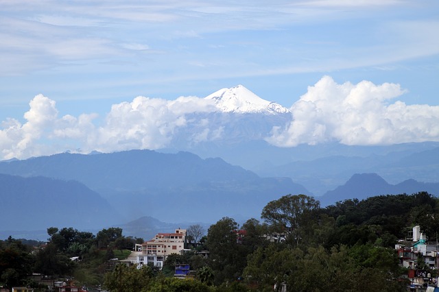
- The volcano sits about 120 miles east of Mexico City and is visible from nearly 70 miles away.
- Pico de Orizaba sits on the Continental Divide on the border of the Mexican states of Veracruz and Puebla.
- The Citlaltépetl name for the mountain comes from the Nahuatl words meaning “Star Mountain”
- Locals sometimes call the volcano Istaktepetl which means White Mountain.
- Pico de Orizaba formed during the mid- Pleistocene period.
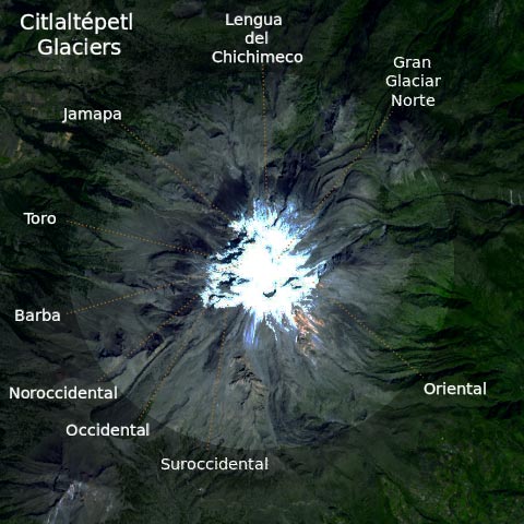
is a dormant, but not extinct, stratovolcano. It last erupted in 1846 with a VEI 2(Volcano.si.edu). - Pico de Orizaba is home to the largest glacier in Mexico: Gran Glaciar Norte.
- There are nine glaciers on Pico de Orizaba that start around 4900 meters. They are Gran Glaciar Norte, Lengua del Chichimeco, Jamapa, Toro, Glaciar de la Barba, Noroccidental, Occidental, Suroccidental, and Orienta.
- A companion peak called Sierra Negra aka Tliltepetl sits 6 km southwest of Orizaba. At 4640 meters | 15,223′ this peak is home to the highest road in North America.
Let’s look at some climbing history on Pico de Orizaba, Mexico:
- 1838: European Botanists Henri Galeotti, Nicolas Funck, Jean-Jules Linden, and Augusto Ghiesbreght made the 1st ascent of Pico de Orizaba.
- 1848: US Soldiers Maynard and Reynolds made the 1st definitive and recorded summit of the volcano.
- 1873: Martin Tritschler raised the Mexican Flag on the summit.
December 16, 1936: On December 16, Mexican President Lazaro Cardenas created a 19,750 hectare national park around the volcano called Parque Nacional Pico de Orizaba. - 1974: W. Furlinger made the first known ski descent of Pico de Orzaba (SkiMountaineer.com).
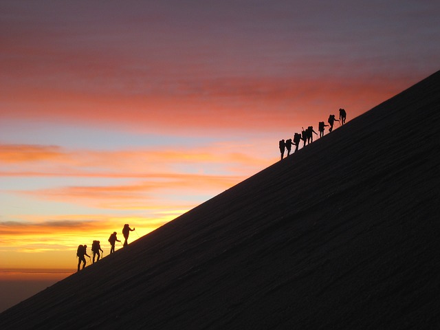
- The standard route on Pico de Orizaba goes from the Piedra Grande Hut 14010′ / 4270 m at up the Jamapa Glacier.
- The most popular time to climb Pico de Orizaba is October to March.
- Pico de Orizaba is a popular ski mountaineering objective. Here are two short videos of ski expeditions to Pico de Orizaba:
![By ISS Expedition 26 crew (NASA Earth Observatory) [Public domain], <a href="https://commons.wikimedia.org/wiki/File:Pico_de_Orizaba,_Mexico.JPG">via Wikimedia Commons</a>](http://mountainjourney.com/wp-content/uploads/2018/06/Pico_de_Orizaba_Mexico.jpg)
Find Pico de Orizaba, Mexico On Google Maps:
Pico de Orizaba, Mexico Recommendations On Amazon.com:
Feel free to contact us if any of the above information is incorrect or if you know of additional interesting facts about Pico de Orizaba, Mexico.
Discover More Interesting Mountain Facts
Sources For Interesting Facts About Pico de Orizaba, Mexico:
- PeakBagger.com
- Wikipedia.org: Pico de Orizaba
- VolcanoDiscovery.com
- Volcano.si.edu
- TheCultureTrip.com
- MissAdventurePants.com
- MountainProject.com
- ThoughtCo.com
- SummitPost.org
- SkiMountaineer.com
- Geo-Mexico.com
- MexConnect.com


